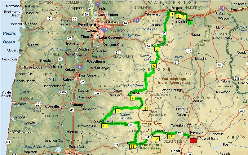
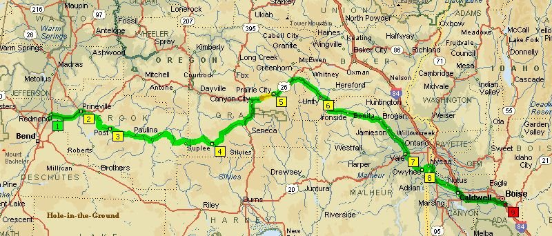
The Dalles to Redmond
 was an absolutely gorgeous 330 mile day although it certainly was windy out until we got south of Hood River.
 Historic Columbia River Highway
 turnout slightly west of The Dalles looking northwest towards the Columbia Gorge in Washington.
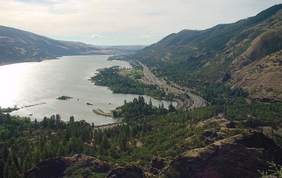 Rowena Overlook
 with view going east towards The Dalles and Columbia River. It was virtually deserted other than myself, Jack, and Mike. Very windy up here!
 Rowena Crest
 can be read (the larger text, that is) by clicking on the pic.
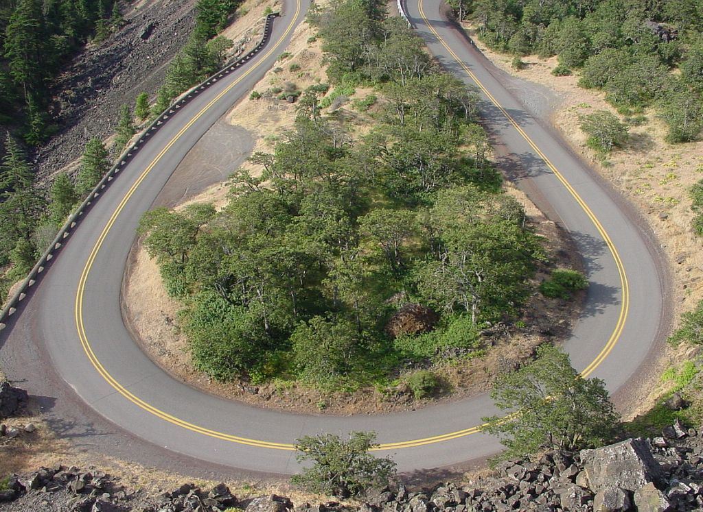
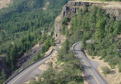 Rowena Loop
 is a superbly designed and paved winding road going up to the crest. Couldn't get all of it with one photo.
 Rowena Loop
 close-up. This road is on the cover of
Motorcycle Journeys Through the Pacific Northwest by Bruce Hansen.
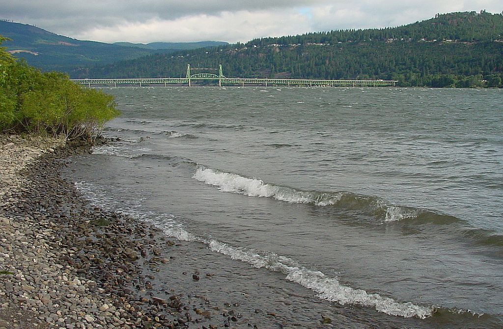
 Hood River Bridge
 west of Koberg Beach SRA is a toll bridge. We could see rain clouds coming up.
 Koberg Beach SRA
 has a fern grotto in the parking lot. ;^)
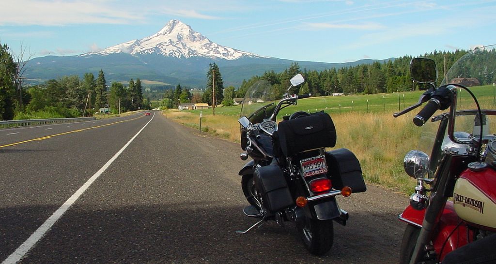
 Mt. Hood
, 11,240' high, to the south from Mt. Hood Hwy (SR-35) in Upper Hood River Valley near the town of Mount Hood. Had to stop in the 'hood for a pic.
 Huckleberry Inn
 in Government Camp where we had some breakfast, and lots of coffee that cold morning before getting back on southbound US-26 to just past Clear Lake.
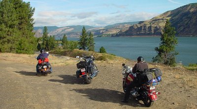
 Timothy Lake
 wasn't on the agenda, but we took the wrong fork on Skyline Rd (NF-42) to Timothy Lake Rd (NF-57). Well worth the detour to the Hoodview campsite as it's very picturesque here.
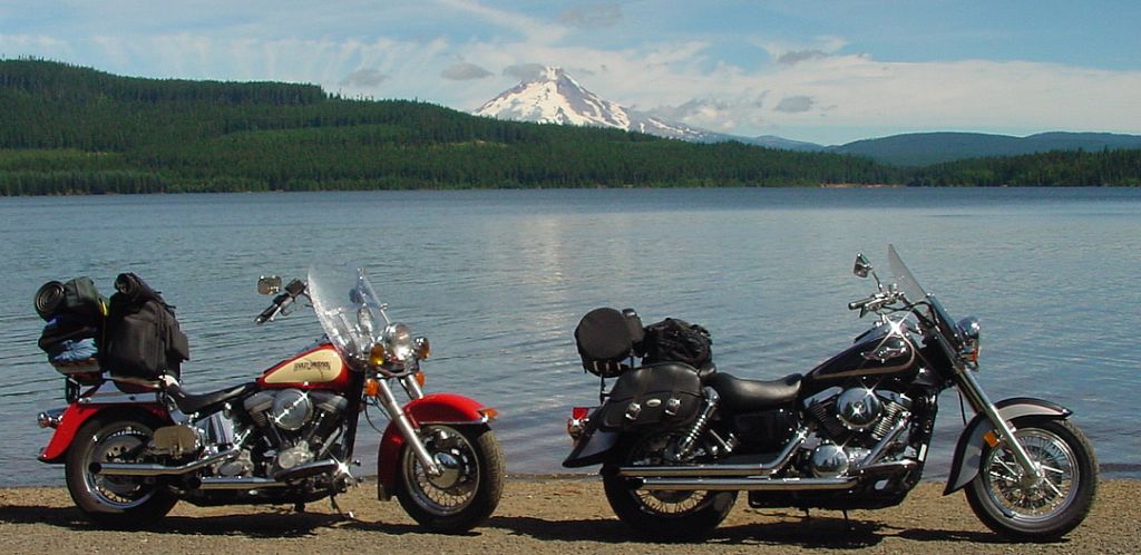
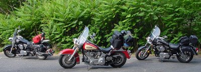
 Timothy Lake
 at the boat launch area was a nice background for our cruisers. ;^)
We returned to Skyline Rd and had a most excellent one-lane ride to the jct of southbound Clackamas River Rd. Was enjoying the ride too much to stop for pics.
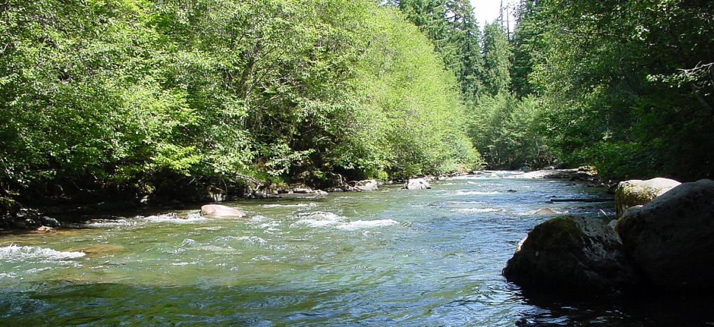
 Breitenbush River
 by Breitenbush Road (NF-46) enroute to Detroit Lake.
 Breitenbush River
 bridge where we took a butt break.
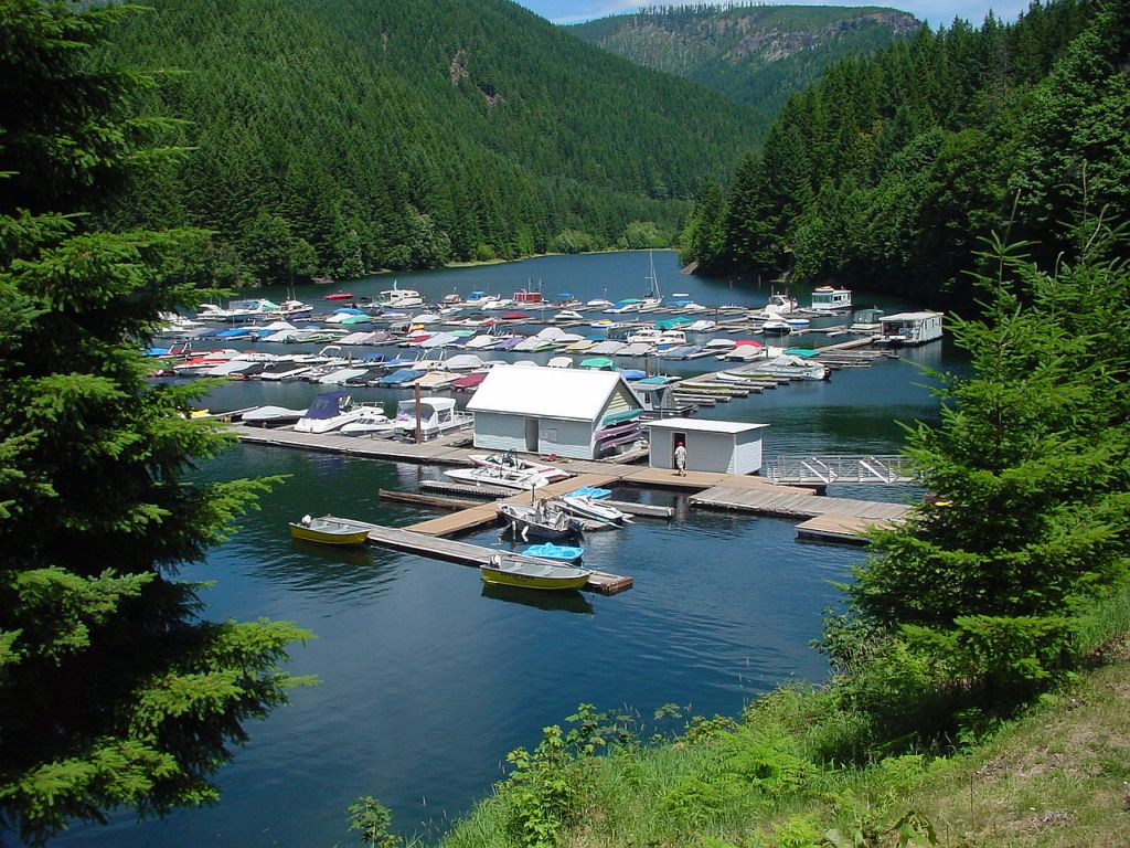
 Detroit Lake Marina
 at the jct of SR-22/NF-46 where we stopped for fuel and refreshments. This was a nice place to hang out at!
 Detroit Lake Marina
 store has a patio overlooking the marina where we enjoyed some cold ones for awhile. We then cut southwest on Santiam Highway (SR-22) to Quartzville Rd (NF-11).
 Quartzville Road Back Country Byway
 meanders along the emerald depths of Green Peter Reservoir and the clear, cool waters of Quartzville Creek National Wild and Scenic River. This is a corridor of old-growth and maturing forest, accented by rock outcroppings, huckleberry patches, wildflowers, and parked motorcycles. ;^)
 Quartzville Road Overlook
 at the summit with view out to the west. This was a gnarly road at times thanks to frost heaves, potholes, rocks, and cracks.
 Quartzville Road Bridge
 spanning Quartzville Creek where we took a butt break.
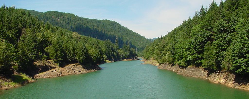
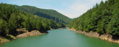 Green Peter Lake
 is located in the beautiful Willamette Valley on the Middle Santiam River along Quartville Road.
 Green Peter Lake
 bridge that connected from Quartville Road to a southbound dirt road.
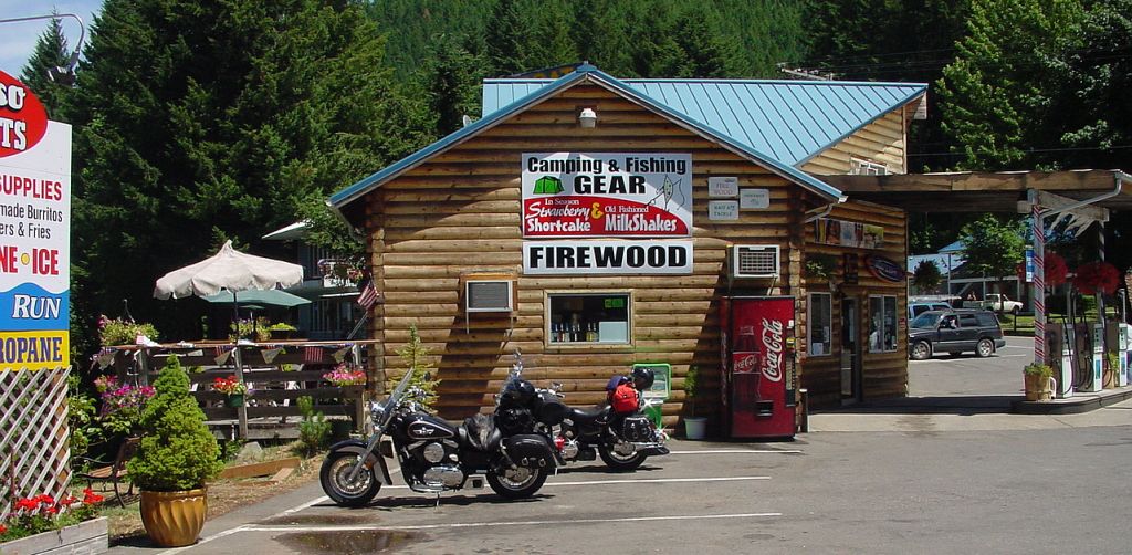
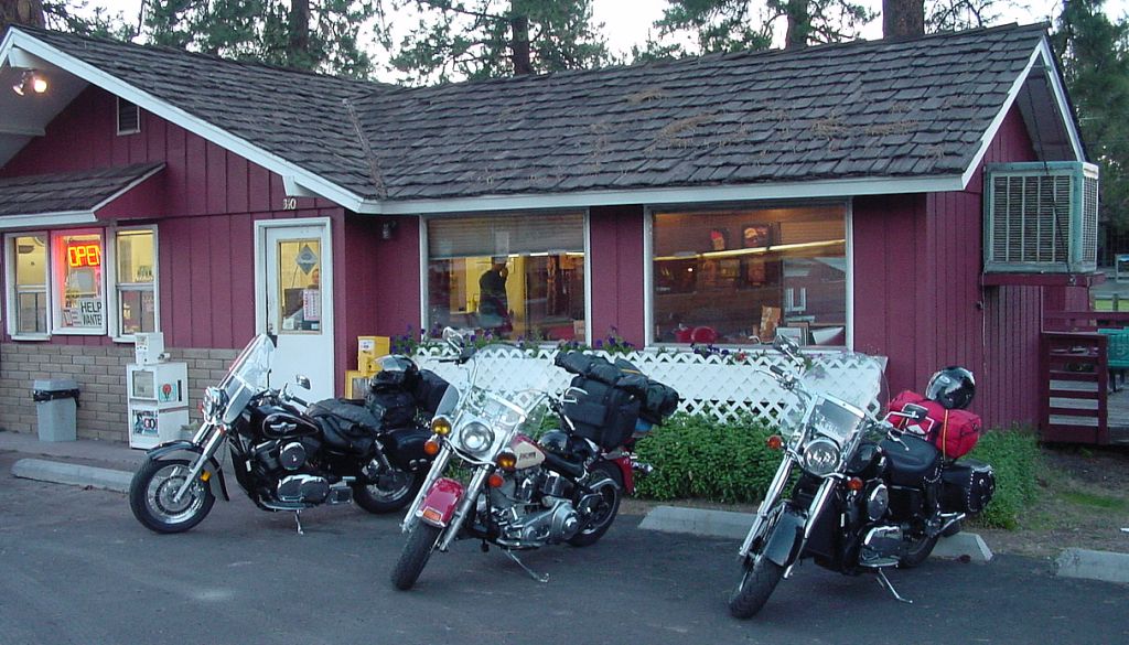
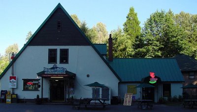 McKenzie Bridge General Store
. We bypassed McKenzie Pass while on SH-126 to come out here for fuel and food only to find nothing available unless we rode another couple of miles west. Took a short butt break here before riding back to the McKenzie Highway (SH-242) jct.
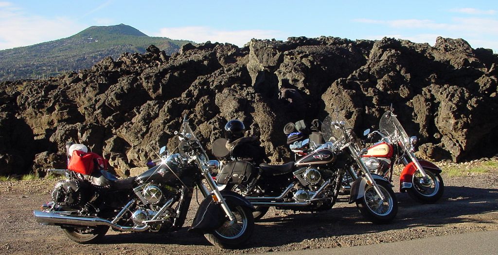
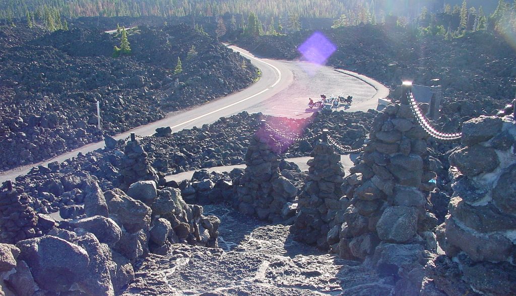
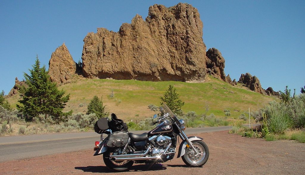
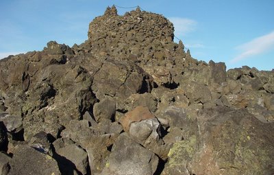
 McKenzie Pass
 is loaded with lava rocks quite a bit larger than our cruisers. I think that's Scott Mountain (6116') in the background. It was quite a ride up from Deadhorse Grade!
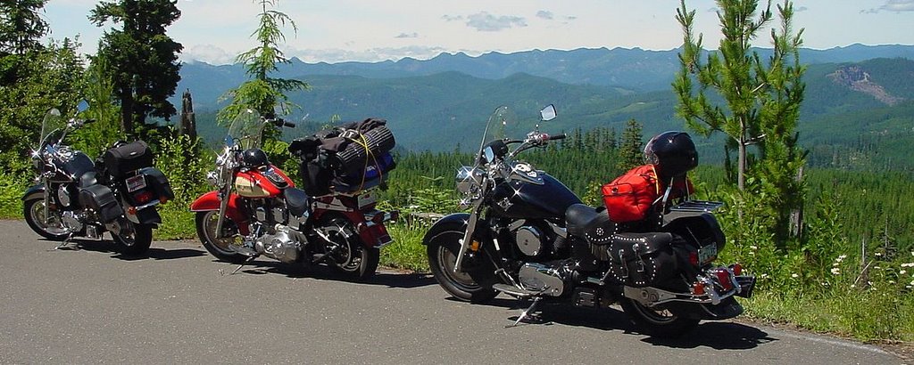
 Three Sisters Viewpoint
 near summit of McKenzie Pass with Three Cruisers in the foreground. :)
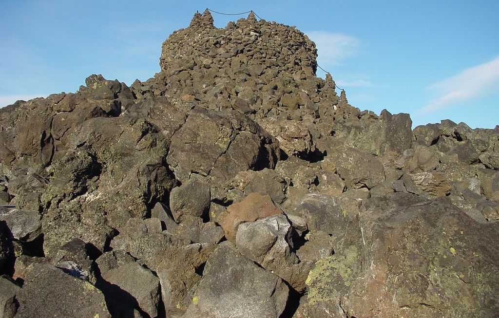
 Dee Wright Observatory
 was built from lava rocks, and has a spiral lava path and staircase that climbs all the way up to the top.
 Dee Wright Observatory
 from the top looking down towards the parking lot and forest surrounded by lava rocks. Duh.
 McKenzie Pass
 is at an elevation of 5325' and, trust me, it's much easier to navigate this road while eastbound. We descended down this road to Sisters for gas.
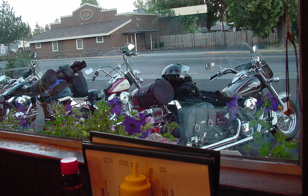
 Sisters
 is a pretty cool town, and we stumbled across the Ski Inn seen in this pic for supper. Since it was really nice out, we ate outside on the patio.
 Sisters
. A final shot of our rides before departing the Ski Inn for Redmond where we called it a late night at the Super 8.
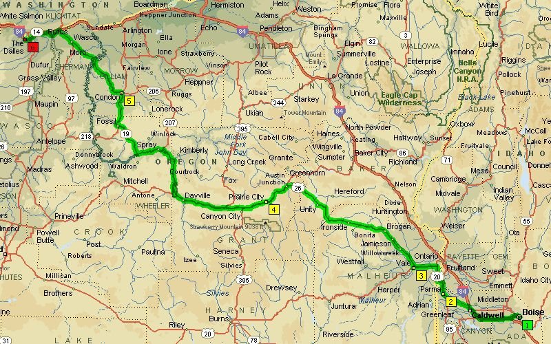 Boise to The Dalles was a long, hot 380 mile ride after Dayville. We got fuel in Nampa, had an excellent breakfast & service at the Starlite Cafe in Vale, gas in Mt. Vernon, a butt break east of Spray, and topped off our tanks in Condon enroute to the Super 8 motel in The Dalles.
  Covered Wagon Viewpoint east of Prairie City. A
  Covered Wagon Viewpoint looking west towards the mountains by Prairie City.
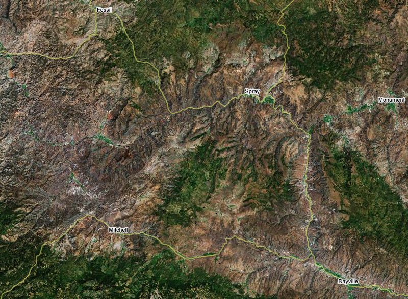 John Day Highway was an excellent ride going northwest from near Dayville to Fossil. We should've stopped at the Service Creek Stage Stop, which had several sportbikes parked out front, north of the SR-207 jct on SR-19. Got very windy as we got closer to The Dalles.